Botswana
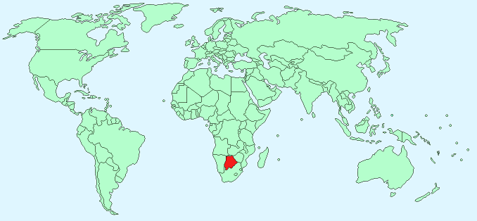
Continent – Africa
Region – Southern Africa
Size – 600,370 km²
Geography – Mainly flat with some hills, Kalahari desert to south-west
Language – 78% Setswana, 7.9% Kalanga, 2.8% Sekgalagadi, 2.1% English, 8.6% other
Religion – 71.6% Christian, 20.6% none, 6% Badimo
Monetary Unit – Pula
Natural Resources – diamonds, copper, nickel, salt, soda ash, potash, coal, iron ore, silver
Agriculture – livestock, sorghum, maize, millet, beans, sunflowers, groundnuts
Industry – diamonds, copper, nickel, salt, soda ash, potash; livestock processing; textiles
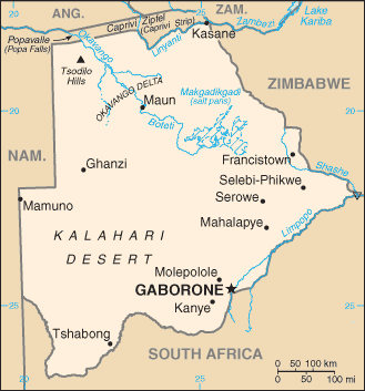
Neighbouring Countries – Zimbabwe, South Africa, Namibia
Population – 2,155,784 (2014)
Population Growth Rate – 1.50%
Average Life Expectancy – 50.58
Capital City – Gaborone (population 231,626)
Highest Mountain – No mountains – highest point Tsodilo Hills (1,489 m)
Longest River – Okavango (1,600 km in Botswana and Namibia)
Climate – Warm winters 5°C to 24°C and hot summers 16°C to 32°C
Yearly Rainfall – 50cm approx
Plant Life – baobab tree, grasses, acacia thornbush
Animal Life – 164 mammal species including lion, leopard, buffalo, rhino, elephant, wildebeest, impala, hippopotamus, giraffe, zebra, 157 reptile species including crocodile, African rock python, leopard tortoise
Aquatic Life – tilapia (African bream), catfish, tigerfish
Harvard Reference for this page:
Heather Y Wheeler. (2015). Botswana. Available: https://www.naturalhistoryonthenet.com/Facts_Figures/Country_Facts/botswana.htm. Last accessed Monday, July 18, 2016
Facts and Figures Pages