Liberia
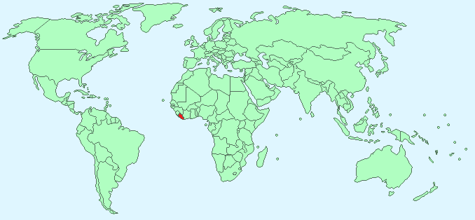
Continent – Africa
Region – Western Africa
Size – 111,369 km²
Geography – flat with coastal plains and some hills
Language – English (official), ethnic languages
Religion – Christian 85.6%, Muslim 12.2%, other 2.2%
Monetary Unit – Liberian dollar
Natural Resources – iron ore, timber, diamonds, gold, hydropower
Agriculture – rubber, coffee, cocoa, rice, cassava (manioc, tapioca), palm oil, sugarcane, bananas; sheep, goats; timber
Industry – mining (iron ore), rubber processing, palm oil processing, timber, diamonds
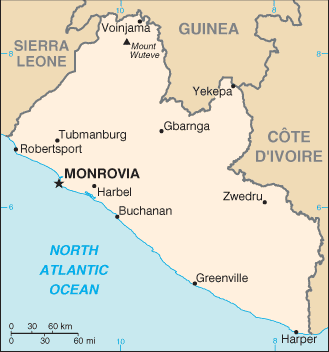
Neighbouring Countries – Sierra Leone, Guinea, Cote D’Ivoire
Population – 4,092,310 (2014 estimate)
Population Growth Rate – 2.52%
Average Life Expectancy – 58.21
Capital City – Monrovia (750,000)
Highest Mountain – Mount Wuteve (1,380m)
Longest River – Cavalla (515 km in Liberia, Guinea and Cote D’Ivoire)
Climate – Tropical – hot, wet winters – 24°C to 31°C and hot dry summers 20°C to 29°C
Yearly Rainfall – 150 cm (approx) mostly July to October
Plant Life – Mahogany, iron wood, cotton tree, kola tree, rubber tree, coffee, citrus, apples, pineapple, papaya, mango, and avocado
Animal Life – antelope, lemur, monkeys, wild pigs, porcupines, leopard
Bird Life – hornbill, wild guinea fowl, cattle egret (cowbird), flamingo, woodpecker, weaver
Harvard Reference for this page:
Heather Y Wheeler. (2015). Liberia. Available: https://www.naturalhistoryonthenet.com/Facts_Figures/Country_Facts/liberia.htm. Last accessed Monday, July 18, 2016
Facts and Figures Pages