Cambodia
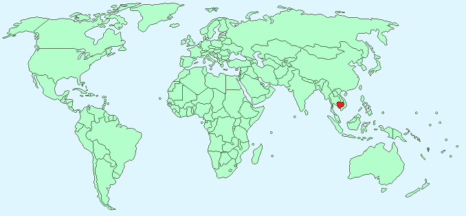
Continent – Asia
Region – South-east Asia
Size – 181,040 km²
Geography – Mostly low plains, mountains in north and south-west
Language – Khmer (official), English, French
Religion – 95% Buddhist, 5% Other
Monetary Unit – Riel
Natural Resources – oil and gas, timber, gemstones, some iron ore, manganese, phosphates
Agriculture – rice, rubber, corn, vegetables, cashews, tapioca
Industry – tourism, garments, rice milling, fishing, wood and wood products, rubber, cement, gem mining, textiles
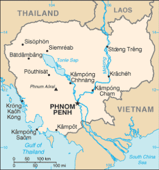
Neighbouring Countries – Thailand, Laos, Vietnam
Population – 15,458,332 (2014 estimate)
Population Growth Rate – 1.73%
Average Life Expectancy – 61.3
Capital City – Phnom Penh (population 1,501,725)
Highest Mountain – Phnum Aoral (1,810 m)
Longest River – Mekong 468km in Cambodia
Climate – Tropical wet monsoon May – November – 24°C to 34°C, tropical dry December – April – 21°C to 34°C
Yearly Rainfall – 140cm (approx) mostly in wet season
Plant Life – palm, rubber, coconut, kapok, mango, banana, and orange trees, grasses
Animal Life – elephants, wild oxen, panthers, bears, snakes, insects
Bird Life – cranes, pheasants, and wild ducks
Harvard Reference for this page:
Heather Y Wheeler. (2015). Cambodia. Available: https://www.naturalhistoryonthenet.com/Facts_Figures/Country_Facts/cambodia.htm. Last accessed Monday, July 18, 2016
Facts and Figures Pages