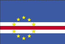
Cape (Cabo) Verde
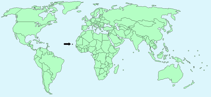
Continent – Africa
Region – Western Africa
Size – 4,033 km²
Geography – Group of rocky, volcanic islands
Language – Portuguese
Religion – Mostly Roman Catholic, some Protestant,
Monetary Unit – Cape Verdean escudo
Natural Resources – salt, basalt rock, limestone, kaolin, fish, clay, gypsum
Agriculture – bananas, corn, beans, sweet potatoes, sugarcane, coffee, peanuts; fish
Industry – food and beverages, fish processing, shoes and garments, salt mining, ship repair
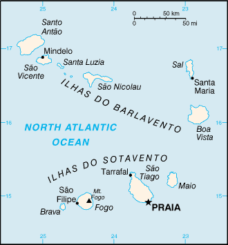
Neighbouring Countries – None – group of islands
Population – 538,535 (2014 estimate)
Population Growth Rate – 0.60%
Average Life Expectancy – 71
Capital City – Praia (population 130,271)
Highest Mountain – Fogo (2,829 m)
Longest River – No significant rivers
Climate – Temperate – warm, dry all year 19°C to 29°C
Yearly Rainfall – South -26cm (approx) mostly in August and September
Plant Life – Most natural vegetation cleared for agriculture – bananas, corn, beans, sweet potatoes, sugarcane, coffee
Animal Life – Limited – long-eared bat is the only native mammal
Bird Life – 75 species of bird
Aquatic Life – dory, sawfish, victor fish, moray, grouper, tuna, dolphins, whales, lobster, crab, shellfish
Harvard Reference for this page:
Heather Y Wheeler. (2015). Cape Verde. Available: https://www.naturalhistoryonthenet.com/Facts_Figures/Country_Facts/cape_verde.htm. Last accessed Monday, July 18, 2016
Facts and Figures Pages