Iran
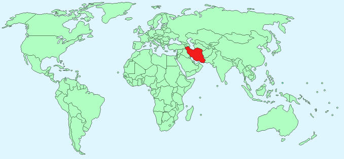
Continent – Asia
Region – Southern Asia
Size – 1,648,195km²
Geography – costal plains, central basin with deserts and mountains
Language – Persian 58%, Turkic 26%, Kurdish 9%, Luri 2%, Balochi 1%, Arabic 1%, Turkish 1%, other 2%
Religion – Muslim 98%, other 2%
Monetary Unit – Iranian Rial
Natural Resources – petroleum, natural gas, coal, chromium, copper, iron ore, lead, manganese, zinc, sulphur
Agriculture – wheat, rice, other grains, sugar beets, sugar cane, fruits, nuts, cotton; dairy products, wool; caviar
Industry – petroleum, petrochemicals, fertilizers, caustic soda, textiles, cement, construction materials, food processing, ferrous and non-ferrous metal fabrication, armaments
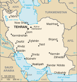
Neighbouring Countries – Afghanistan, Armenia, Azerbaijan, Iraq, Pakistan, Turkey, Turkmenistan
Population – 80,840,713 (2014 estimate)
Population Growth Rate – 1.22%
Average Life Expectancy – 70.89
Capital City – Tehran (8,293,140)
Highest Mountain – Kuh-e Damavand (5,671m)
Longest River – Karun 720km
Climate – continental climate with cold winters – -3°C to 7°C and hot summers 22°C to 37°C,
Yearly Rainfall – less than 30cm (approx)
Plant Life – oak, ash, elm, cypress, and plane tree, poplar, willow, walnut, beech, maple, mulberry, spring plants and shrubs
Animal Life – Bears, wild sheep and goats, gazelles, wild asses, wild pigs, panthers, foxes cattle, horses, water buffalo, donkeys, and camels
Bird Life -pheasant, partridge, stork, and falcon
Harvard Reference for this page:
Heather Y Wheeler. (2015). Iran. Available: https://www.naturalhistoryonthenet.com/Facts_Figures/Country_Facts/iran.htm. Last accessed Monday, July 18, 2016
Facts and Figures Pages