Eritrea
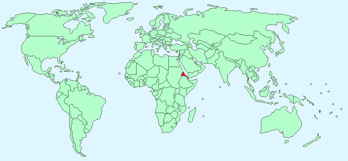
Continent – Africa
Region – Eastern Africa
Size – 121,320 km²
Geography – highlands with eastern desert and south western plains
Language – Afar, Arabic, Tigre and Kunama, Tigrinya, other Cushitic languages
Religion – Muslim, Coptic Christian, Roman Catholic, Protestant
Monetary Unit – Nakfa
Natural Resources – gold, potash, zinc, copper, salt, possibly oil and natural gas, fish
Agriculture – sorghum, lentils, vegetables, corn, cotton, tobacco, sisal; livestock, goats; fish
Industry – food processing, beverages, clothing and textiles, light manufacturing, salt, cement
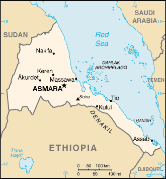
Neighbouring Countries – Sudan, Ethiopia, Dijibouti
Population – 6,380,803 (2014 estimate)
Population Growth Rate – 2.44%
Average Life Expectancy – 63.51
Capital City – Asmara (712,000)
Highest Mountain – Soira (3,018 m)
Longest River – No major rivers
Climate – coastal – desert, hot and dry 19°C to 41°C, highlands – cool/warm and wet 6°C to 25°C
Yearly Rainfall – coastal region -10 cm (approx) mostly November to December, highland region – 125 cm (approx) mostly June to September
Plant Life – acacia, cactus, aloe vera, prickly pear, and olive trees
Animal Life – lion, leopard, zebra, species of monkey, gazelle, antelope, and elephant
Fish Aquatic Life – turtle, lobster, and shrimp
Harvard Reference for this page:
Heather Y Wheeler. (2015). Eritrea. Available: https://www.naturalhistoryonthenet.com/Facts_Figures/Country_Facts/eritrea.htm. Last accessed Monday, July 18, 2016
Facts and Figures Pages